ADK ADV LOOP
Route Updates & Conditions
26MAY2026
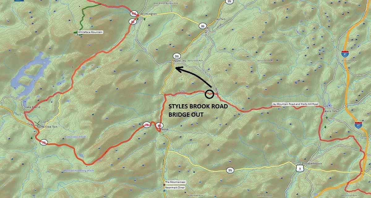
I received a report from someone riding the route this past weekend that a bridge over Styles Brook Road is out and impassable. This is located between Jay Mountain Road and route 9N in Keene. It’s unclear how long the bridge will be out, but for now the best option is to just continue on Jay Mountain Road all the way to 9N instead of turning onto Styles Brook Road.
08MAY2026
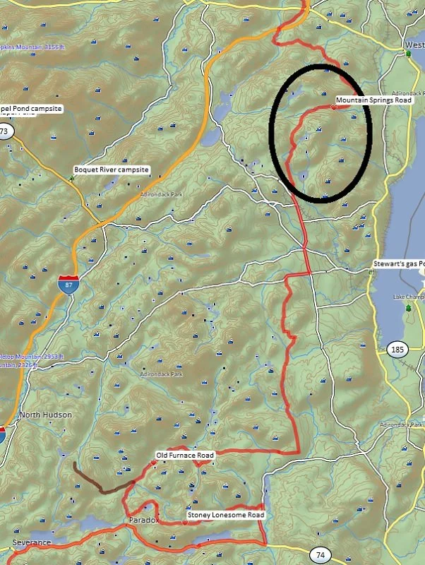
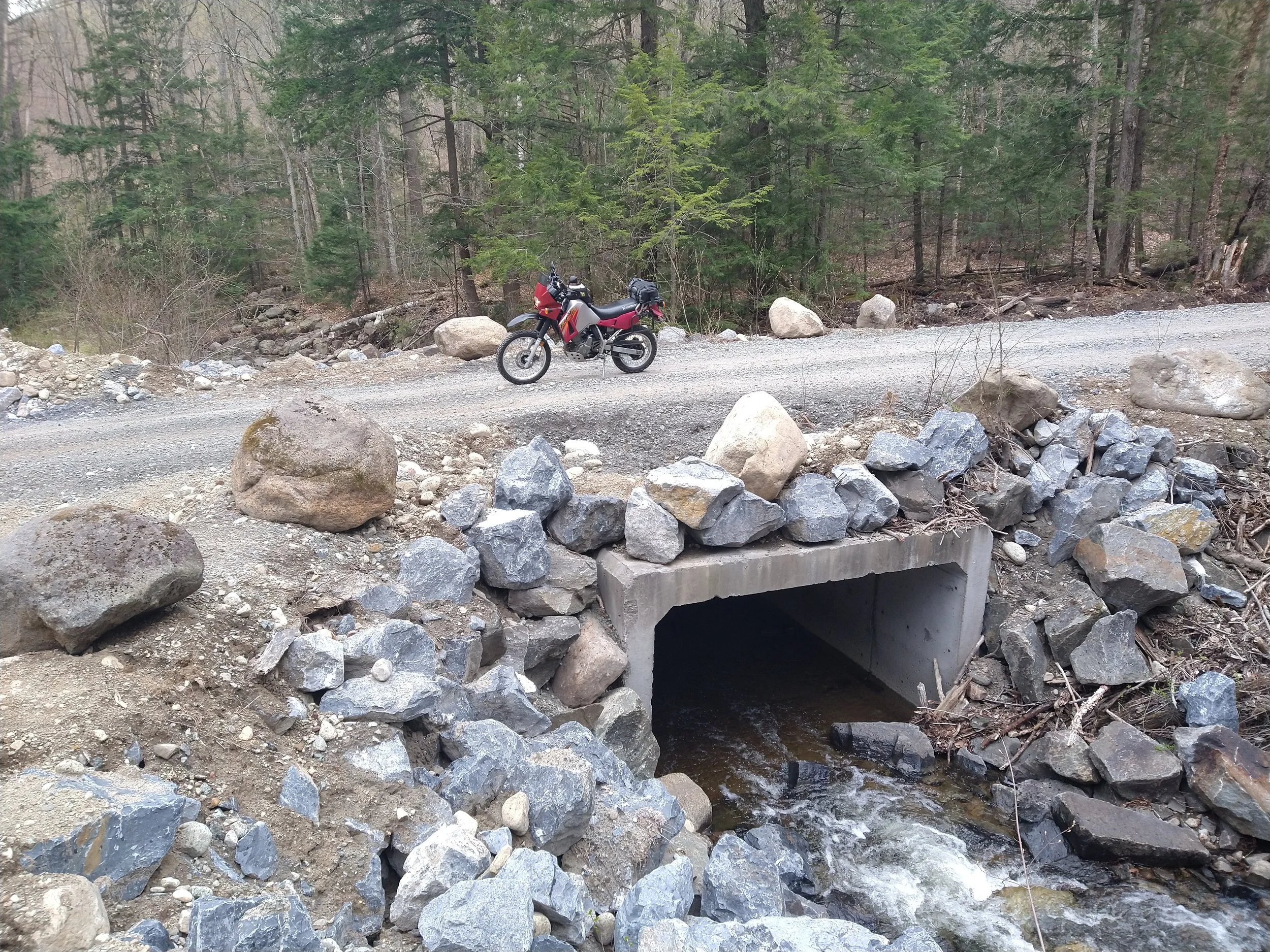
I rode the KLR up to Mineville today to check the condition of Mountain Springs Road since it had been wiped out from a storm last summer, and to my surprise the town had repaired the road. I’m not sure if they did it last fall or this spring but it had been leveled out with new dirt and stone filling in all of the sections that had been washed out. You can still see remanents of the damage along the sides, but it is clear enough for a 4WD truck to get through there now, although it is still a rough road in general as it was before. They even put in a new bridge where the old one had been destroyed. One area of caution however is a section about 100 yards long where they laid down golf ball sized stones which was tricky to ride through.
01MAY2026
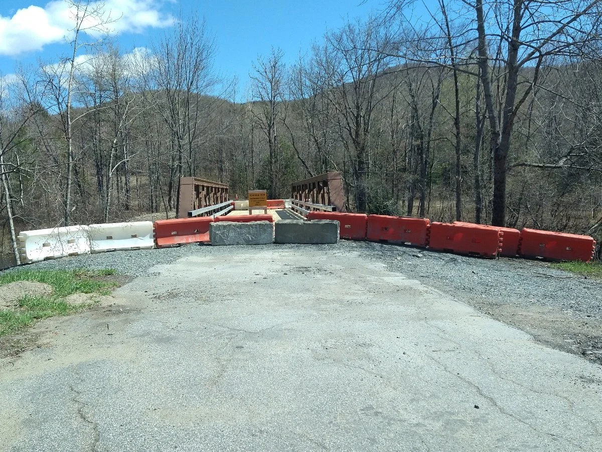
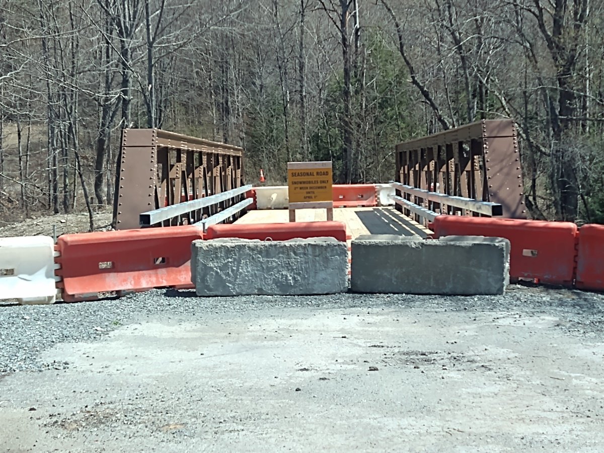
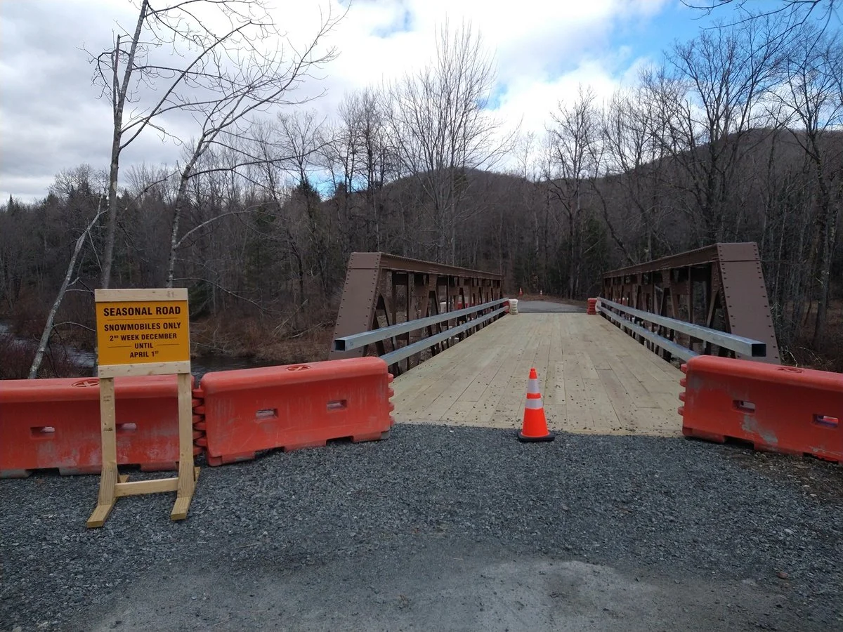
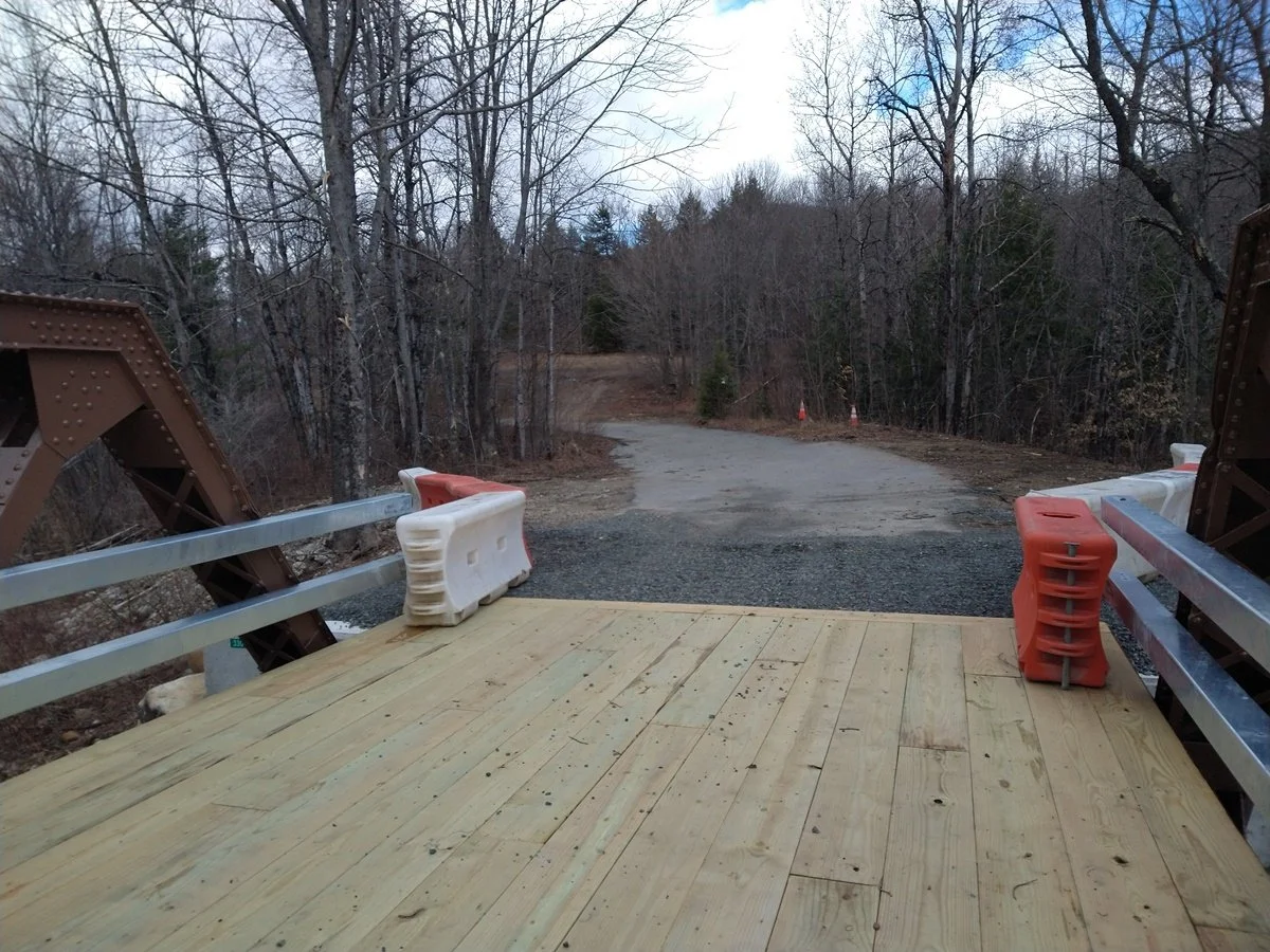
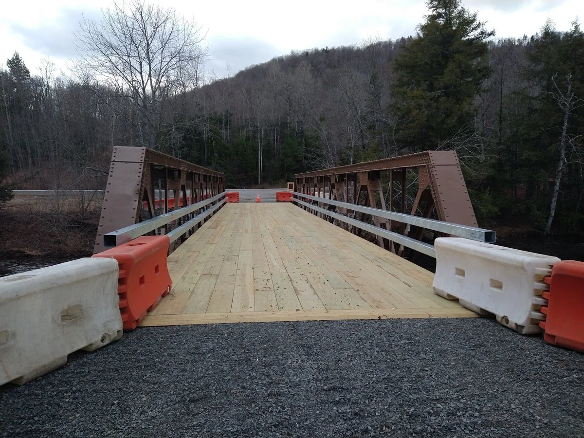
I was doing some trail running around Speculator today and noticed the town put up some barriers in front of the new bridge where “Old” Route 30 (aka Old Route 8B) joins Rte 30. A local told me that they have it closed off while they finish installing the guard rails on the bridge and it will be open in a couple of weeks. It was open all winter for the snowmobiles so apparently they didn’t need guardrails!
The good news is that Fly Creek Road is open already so the Fly Creek Rd / Elm Lake Rd loop through the conservation easement can be ridden now. I ran that part of the route today and it’s all in good shape.
I also noticed a few campsites along Old Route 30 that I’ll be adding to the GPX file.
12APR2026
I was up in Speculator yesterday and checked on trail conditions; there is still snow and ice on the seasonal roads and the gates are still closed so they are not accessible with a motorized vehicle.
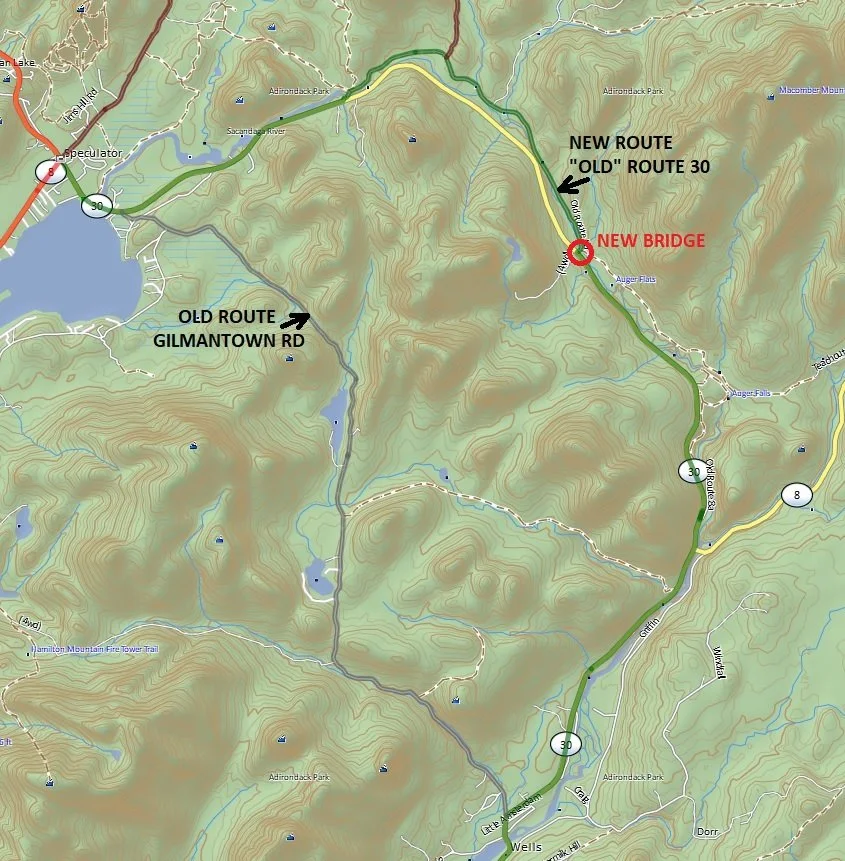
I also noticed some things that led me to change the Tolmantown Road ALT option on the ADK ADV LOOP:
Gilmantown Rd has been paved over so there is no longer any dirt sections on it.
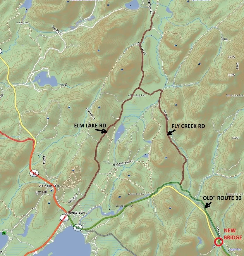
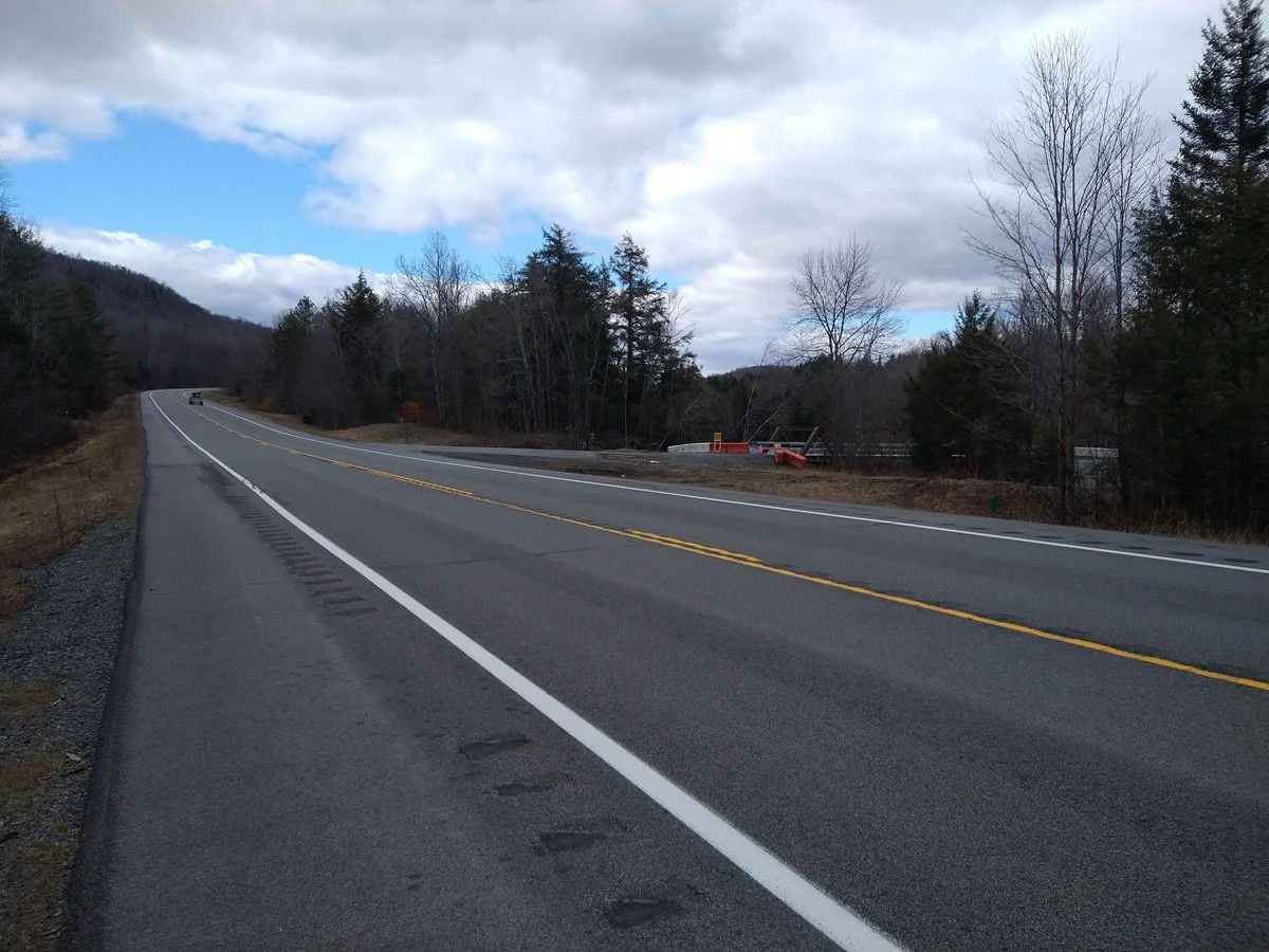
There is a new bridge connecting the east end of “Old” Route 30 (aka Old Route 8B) to Rte 30. This bridge has been closed off for years but they were working on it last year and then it was open this winter for snowmobiles. It is now open for vehicles to pass over the Sacandaga River, giving easy access to Old Route 30 which is a narrow rough road with a few dirt sections. The nice thing about this is that it passes right by Fly Creek Road which is a dirt road that heads north and connects with Elm Lake Road making for a nice dirt loop through a conservation easement. There is a gate on the south end of Fly Creek Rd and it usually isn’t open until later in the year (June), so if it’s closed you can just keep on Old Route 30 which brings you right back to Rte 30 and then into Speculator.
So I’ve made the change to the Tolmantown_Road_ALT track in the GPX file to follow this new route instead of Gilmantown Rd.
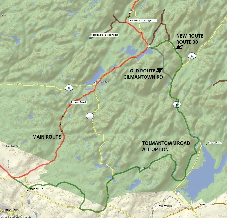
Notes on the Tolmantown Road ALT option:
A few years ago Piseco Rd was damaged from some heavy storms that washed out parts of the road. The town temporarily closed off the road so I created the Tolmantown Road option as a detour. It’s actually a bit longer, more technical, and more interesting than Piseco Road, but is a bit tedious around Dolgeville and doesn’t have many camping options. If you have the time and aren’t looking for a camping spot, then the Tolmantown Road ALT option is worth doing.
Piseco Road: more direct, less technical, many camping options
Tolmantown Road: longer, more technical, few camping options
19JAN2026
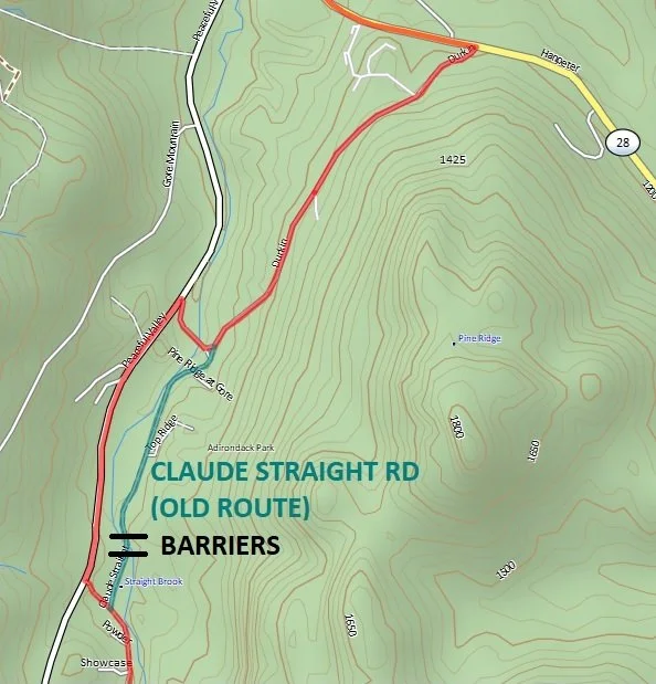
The ADK ADV LOOP has a slight update near Gore Mt in North Creek. The town put up a couple of barriers on Claude Straight Rd in front of the bridge going over the creek, and though you can still get your bike around the barriers they don’t want people riding through there anymore, so the route has been changed to go around this.
15AUG2025
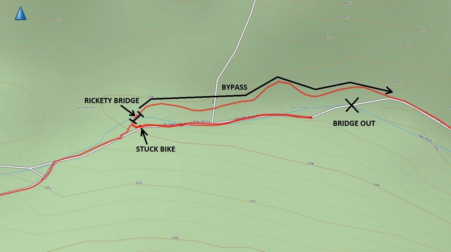
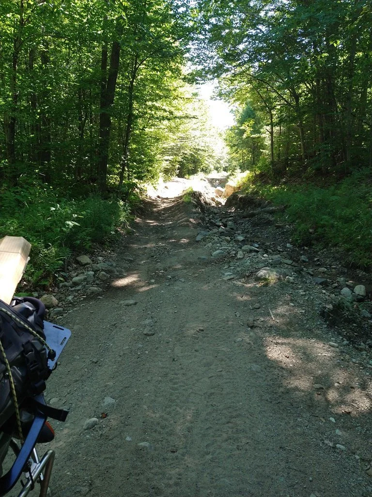
I had a bit of an adventure on Mountain Springs Road this afternoon. I was up in the area picking something up so figured I would go check it out to see if anything had changed since the last report of damage to Mountain Springs Road after the recent storms went through.
There is a "road closed" sign, and the road still has a lot of damage. The washouts are still there but 4 wheelers have made some tracks around the really bad sections. You still have to cross over some really rough loose stuff as you work your way around those sections though. I had some very worn Shinko 705's (80/20 tire) on my Africa Twin and still managed to make it through everything, and then I got to the section where the bridge was out. I stopped short of going all the way down the hill and then walked down to see that the bridge was still completely out and impassable. So I turned around to backtrack out of there but as I was going up the hill along a very narrow ridge of loose rock and sand my rear wheel lost traction and slid sideways off the trail and into a ditch. The bike was still upright but now it was stuck as there was no riding out of this, especially with the tires that I had on. I spent the next 30 minutes or so struggling to lift up the rear end of my 500lb Africa Twin out of the ditch and then saw a guy and girl coming down the trail on their 4-wheelers, so I waved them down for help. With the 3 of us and the winch on their 4-wheeler we were able to pull my bike back up onto the trail. I was so lucky they came along and ended up giving them some cash for helping me out.
They also showed me a bypass trail that goes around the bridge that is out. The bypass goes onto private land but was opened up to the public until the bridge is fixed. It is quite a rough trail with its own rickety bridge, but it is no harder than the rest of Mountain Springs Rd at this point. I was able to ride all the way through via the bypass.
So, the good news is that you can ride all the way through Mountain Springs Rd, but it is very difficult, and you must take the temporary bypass around where the bridge is out. I would say this is for advanced riders only and isn't recommended for fully-loaded big bikes, especially with anything less than 50/50 tires. If I had better tires then I'd have no problem doing it on my Africa Twin, but with no more than 40lbs in soft saddle bags. I would not want to try riding this trail on a big bike with hard panniers as it would just be too unwieldy and you'd probably crush them if you went down. If you are on a smaller bike without too much gear and have some decent off-road skills then this should be no problem.
The bypass trail isn't very obvious, and I don't want to post the tracks since it is technically on private land, but if anyone is interested then send me an email and I can send you the tracks directly.
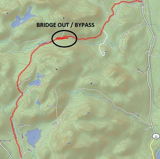
My tracks showing where I turned around before the bridge.